Annamalai Temple, Karikode
An old temple built in a Tamil architectural style that is uncommon in central Kerala.

Gateway to the High Ranges
നമസ്കാരം തൊടുപുഴ.
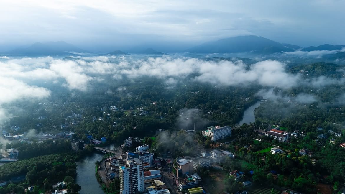
The largest town in Kerala's Idukki district, and the gateway travellers pass through on the way to Munnar, Thekkady and the High Ranges. It sits on the Thodupuzha river, which runs through the year.
Quick facts
Census of India 2011 unless noted. The taluk figure covers a much larger rural area than the town itself, which is where most of the confusion about Thodupuzha's size comes from.
Where it is
Thodupuzha is the transit point between the Kerala midlands and the Idukki high ranges. Roads to Munnar, Thekkady and the Idukki dam run through it, which is how the town earned its name as the gateway. The Thodupuzha river cuts through the municipality and, unlike many rivers in the region, carries water all year.
By road, approximate.
The name
The name joins two Malayalam words, thodu, a small stream, and puzha, a river, for the waterbody that grew into the river the town is built around. A second local reading takes it to mean a town that touches the river. Both point to the same thing: the place and its water are one idea.
The river
The Thodupuzha river runs through the town all year, and the water in it is put to work several times over before and after it passes through.
Water used at the Moolamattom power house is released into the Thodupuzha river system as tailwater. It is caught again a few kilometres downstream at Malankara Dam and sent back out for irrigation, drinking water and a further round of power generation. The Muvattupuzha Valley Irrigation Project built around that dam commands about 18,173 hectares, with 37.1 km of left bank main canal, 28.3 km on the right bank and 57.2 km of branch canals, and it carries a 10.5 MW hydropower component of its own. The benefit is spread across Idukki, Ernakulam and Kottayam.
Downstream the Thodupuzha, Kaliyar and Kothamangalam rivers meet to form the Muvattupuzha river. The basin they drain covers roughly 1,550 square kilometres and takes about 2,800 to 3,000 mm of rain a year, most of it in the southwest monsoon.
History
Culture
Thodupuzha's mix of communities comes from old migrations and royal alliances. Part of the local Muslim population traces back to soldiers of the Madurai Raja, and a section of the Hindu community descends from Vellala families who moved from Tenkasi in Tamil Nadu. That history shows up in the town's places of worship, which sit close together.
An old temple built in a Tamil architectural style that is uncommon in central Kerala.
Commissioned by a regional king for his Muslim soldiers, a marker of the town's shared history.
A Syrian Christian church with roots said to reach back to the 13th century.
A town temple that draws large crowds during Hindu festivals.
Work and trade
Thodupuzha is busier than a town of 52,000 usually is, because it serves a catchment several times its own size.
Four things overlap here. Produce from the surrounding hills moves through the town: rubber, pepper, coconut, cocoa, pineapple, banana, tapioca, ginger and turmeric. Retail and services run well ahead of what the municipal population alone would support, because people from the panchayats around come here to buy. Education, healthcare and government bring a daily population in on top of that, to the schools and colleges, the hospitals, the courts and the district offices. Underneath all of it sits a layer of small and medium businesses, concentrated in food processing, rubber, engineering and agricultural work.
There is no published figure for the town's own economic output, and any number offered as one is worth treating carefully. What these four layers explain is the thing residents notice first: the streets carry far more people than live here.
On screen
The hills, riverbanks and old homesteads have made Thodupuzha a regular filming location for Malayalam cinema, and for some Tamil productions. Several well-known films were shot in and around the town.
Getting here
Thodupuzha has no railway station. Everything arrives by road.
The nearest stations are Piravom Road, Ettumanoor, Kottayam, Aluva and Ernakulam, and which of them is most useful depends on where you are travelling from more than on distance alone. Cochin International Airport is about 55 to 60 km away.
Buses do most of the work. KSRTC and private services both run through the town, and the bus stand is where most people actually arrive. It is also why the junctions around the commercial centre get congested, and why a journey time here depends more on the state of the road than on the number of kilometres. Road distances to the towns around are listed further up this page.
KSRTC and private buses both run through the town, and the bus stand is where most people arrive.
No station in Thodupuzha. Piravom Road, Ettumanoor, Kottayam, Aluva and Ernakulam are the usual options.
Cochin International Airport is about 55 to 60 km away by road.
Nearby
Malankara Dam is built across the Thodupuzha river about 7 km from town at Muttom. The reservoir stays open through the year and has boating, a children's park and walking tracks.
Thommankuthu is a seven-step waterfall about 18 km from Thodupuzha, part of a series of twelve falls over five kilometres. A 12 km guided trek runs through the forest, and it is one of Kerala's main ecotourism points.
Aanachadikuthu, also called Anayadikuthu, is a waterfall about 20 km from Thodupuzha and roughly a kilometre from Thommankuthu. It drops around 30 metres and is one of the safer falls in the district, a short walk from the parking area.
Ilaveezhapoonchira is a viewpoint about 20 km from Thodupuzha, near Kanjar. It is often listed as a Thodupuzha attraction, but it sits inside Kottayam district, not Idukki. Three hillocks rise to about 960 metres, and the final stretch needs a four wheel drive. The name refers to a valley where leaves are said not to fall.
Uravappara is a hillock at Olamattom near Thodupuzha, about 150 metres above sea level, with views over the town. The Uravappara Sree Subramanya Swami temple sits on the hill and is linked in legend to the Pandavas' exile.
The Nedumala caves at Piralimattom are about 10 km from Thodupuzha, on the Idukki–Ernakulam border. They are a prehistoric rock shelter with carved cupules and grinding surfaces, studied as a Neolithic-era site.
Aruvikuthu is a remote waterfall about 10 km from Thodupuzha, reached by a short trek. The rocks around it can be slippery and there have been drowning accidents, so it is best viewed with care and not for swimming.
Kuruvakkayam is a multi-tiered waterfall about 18 km from Thodupuzha on the Poomala route, reachable by the Poomala bus. It has a pool at the base and sits deep in the hills.
Setting it straight
A few claims about this town travel further than the facts behind them. These are the ones we see most often.
Often saidThe population is three or four lakh
ActuallyThat is the old taluk figure, which covered a large rural area around the town. Thodupuzha town itself recorded 52,045 people at the 2011 Census.
Often saidThodupuzha is a hill station
ActuallyIt sits at about 40 metres above sea level. It is a low range town at the foot of the ranges, which is exactly why it works as the way into them.
Often saidThe sex ratio is 1,084 women per 1,000 men
ActuallyThat is Kerala's state figure. Thodupuzha's own 2011 counts, 25,563 men and 26,482 women, give about 1,036.
Often saidIlaveezhapoonchira is in Thodupuzha
ActuallyIt is reached from here and almost always listed with Thodupuzha, but it lies inside Kottayam district, near Melukavu.
Often saidIt is the fastest growing town in Kerala
ActuallyRepeated in a lot of places. We could not find a statewide ranking that supports it, so we do not print it as a fact.
Often saidThe population in 2026 is such and such
ActuallyThe 2011 Census is the most recent complete count at town level. Anything newer is a projection, and should say so.
Our town
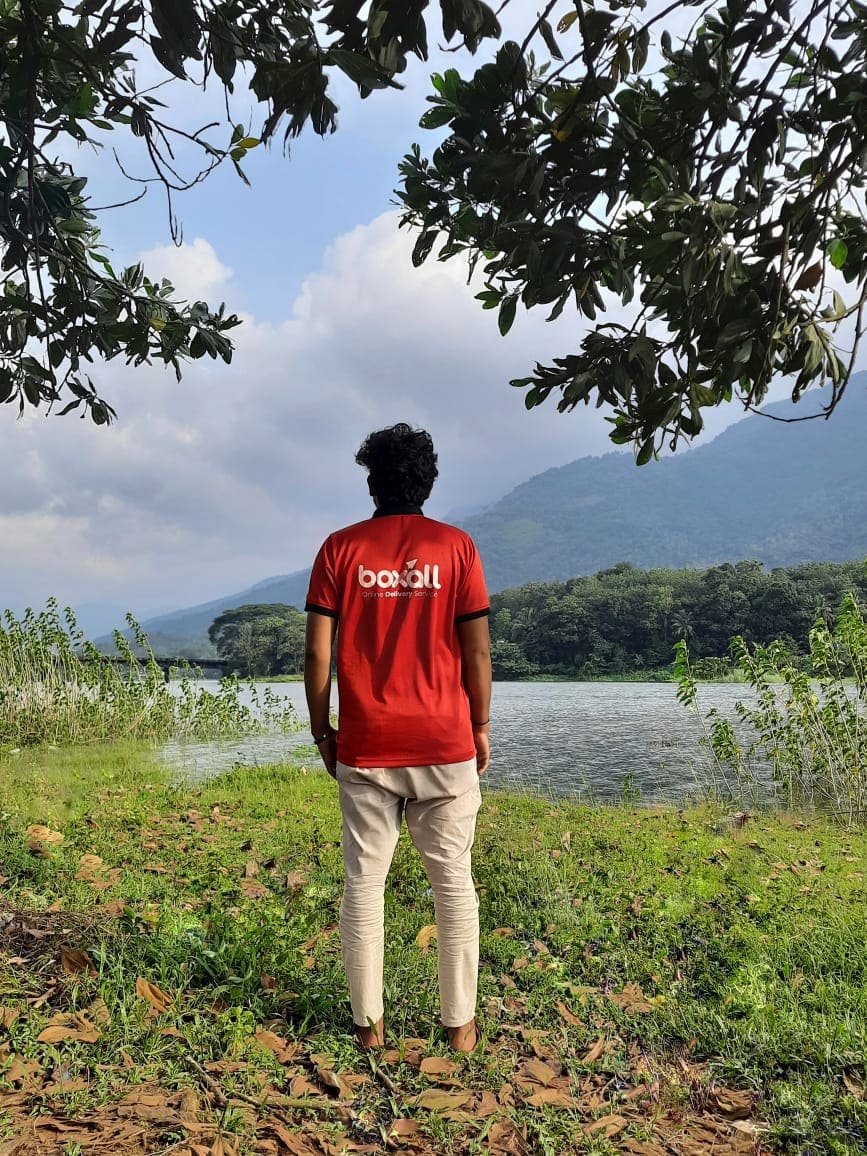
Boxall is Thodupuzha's own delivery service. We are on these roads every day, which is why this guide exists and why we can bring you anything the town has to offer.
നമസ്കാരം തൊടുപുഴ.
The guide
Hospitals in town, with delivery to the ward.
Colleges and campuses, with hostel delivery.
Places to eat in town, order food on Boxall.
Local shops on the app, plus pickup and drop.
Waterfalls, dams and viewpoints around town.
Straight answers about ordering in Thodupuzha.
Where to stay, with delivery to the room.
Coming soonQuestions
Thodupuzha is in the Idukki district of Kerala. It is the district's largest town and its own municipality.
It is known as the Gateway to the High Ranges, the transit town on the way to Munnar, Thekkady and the Idukki hills. It sits on the Thodupuzha river and is a regular filming location for Malayalam cinema.
Thodupuzha is about 62 km from Kochi by road.
The pincode of central Thodupuzha is 685584. Nearby areas use other 685xxx codes.
The Thodupuzha river, or Thodupuzhayar, runs through the town and flows through the year.
Thodupuzha town recorded 52,045 people at the 2011 Census, in 12,604 households. The figure of about 3.26 lakh that circulates online is the old Thodupuzha taluk, which covered a much larger rural area than the town.
No. Thodupuzha sits at about 40 metres above sea level. It is a low range town at the foot of the Idukki hills, and it is the road you take to reach the high ranges rather than a destination in them.
No. There is no railway station in Thodupuzha. The usual options are Piravom Road, Ettumanoor, Kottayam, Aluva and Ernakulam, depending on where you are travelling from. Cochin International Airport is about 55 to 60 km away.
Sources
Order now